 Investigate Alabama's Ecoregions
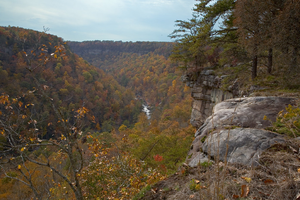 |
| Little River Canyon flickr – Alby Headrick Click on image to enlarge it
|
An ecoregion is a major ecosystem defined by its distinct geographic region and environmental conditions such as solar radiation and moisture and its natural communities.
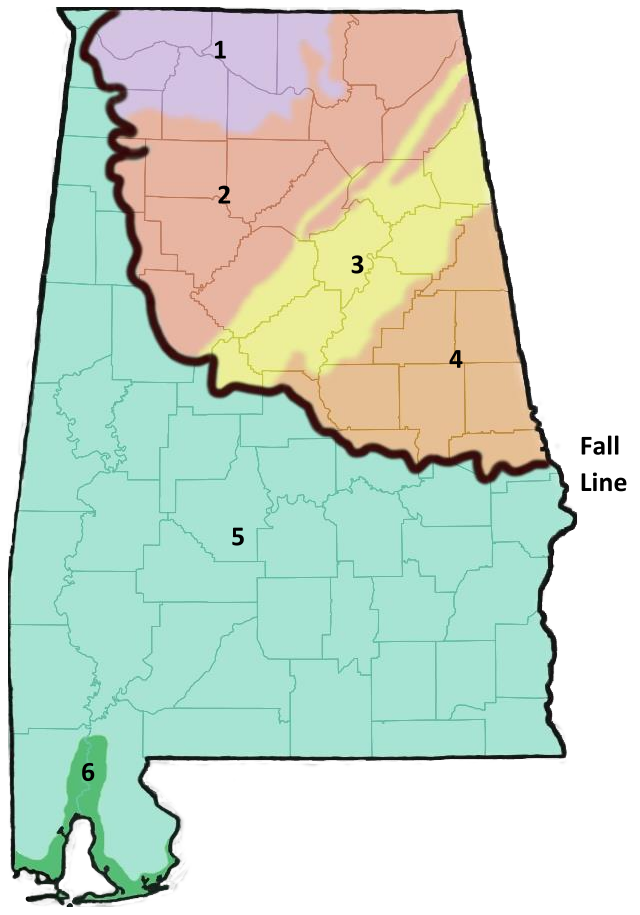
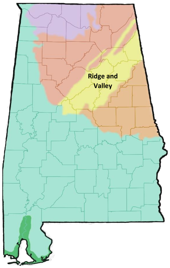
Alabama contains a diverse set of geographic features including ridges and valleys, Appalachian foothills, cave systems, rivers, lakes, swamps, flat plains, and coastal habitats. The more mountainous regions in the northeastern part of the state are separated from flat plains in the southern part of the state by the fall line. The fall line is a visible geographic feature characterized by a change in elevation and rock structure. The diversity in the geographic features of Alabama has resulted in a high diversity of species in the state. Alabama has 6 distinct ecoregions, each characterized by a set of physical characteristics and biological communities.
| Click the ecoregions below to learn more about them! | ||
 |
||
To explore more ecosystems and biomes across the world, visit The Wild Classroom's Explore Biomes page or NASA Earth Observatory's Mission: Biomes page.
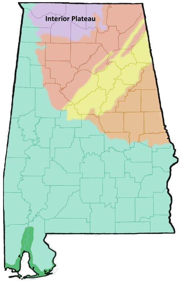
| Interior Plateau | |||
| Description: | |||
|
 |
||
| Geology: | |||
|
|
||
| Habitats: | |||
|
 Geology Freatures at Cane Creek Nature Preserve
flickr – Michael Hicks Click on image to enlarge it |
||
| Notable Landmarks and Species: | |||
|
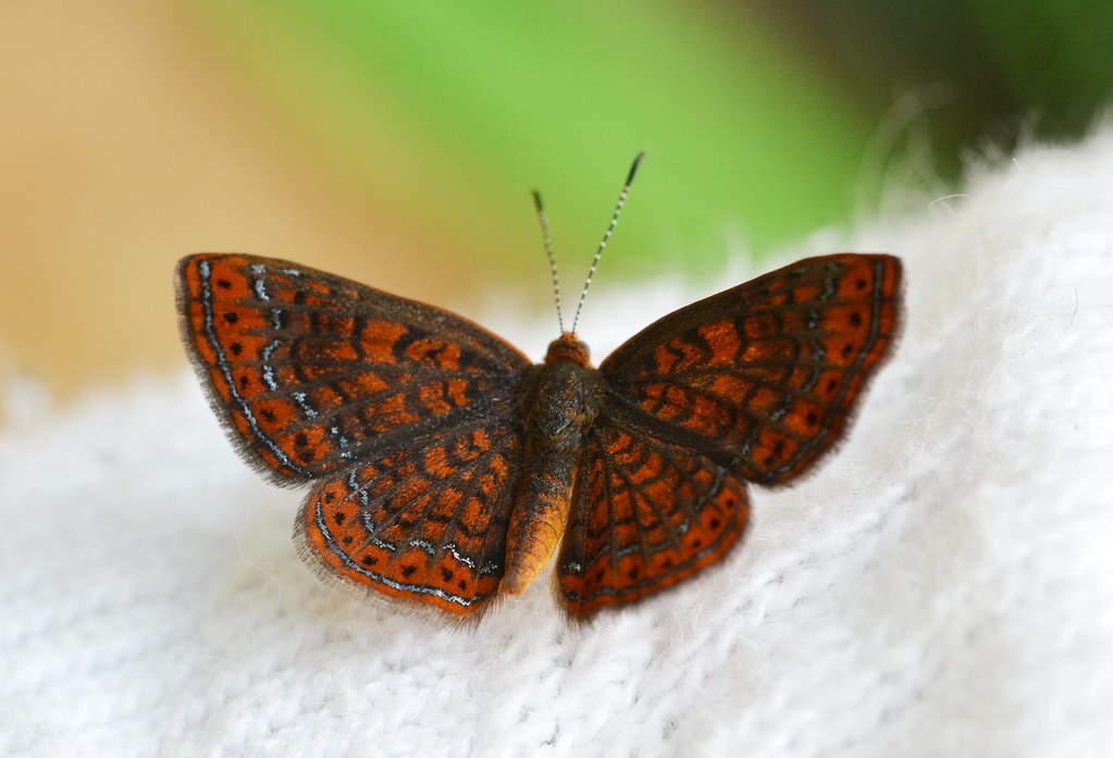 Swamp Metalmark
flickr – Andy Reago & Chrissy McClarren Click on image to enlarge it |
||

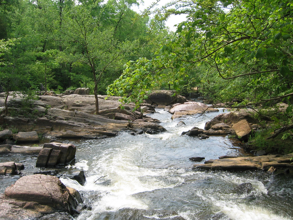
| Southwestern Appalachians | ||
| Description: | ||
|
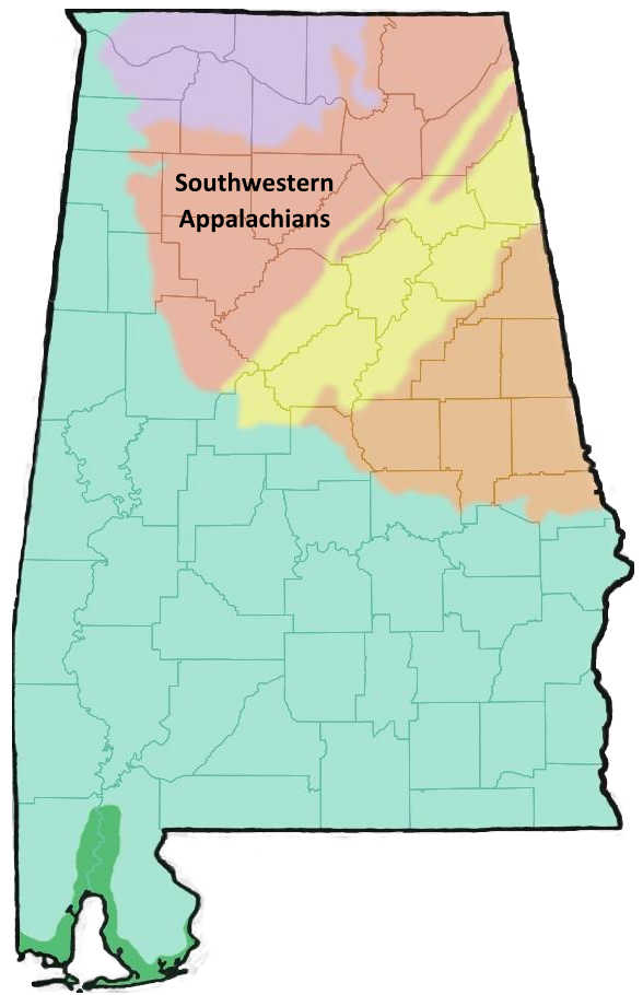 |
|
| Geology: | ||
|
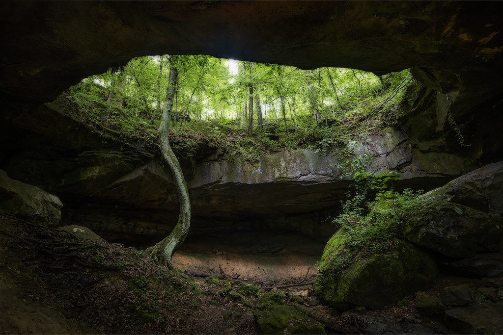 Bankhead National Forest
flickr – Outdoor Alabama – Keith Bozeman Click on image to enlarge it |
|
| Habitats: | ||
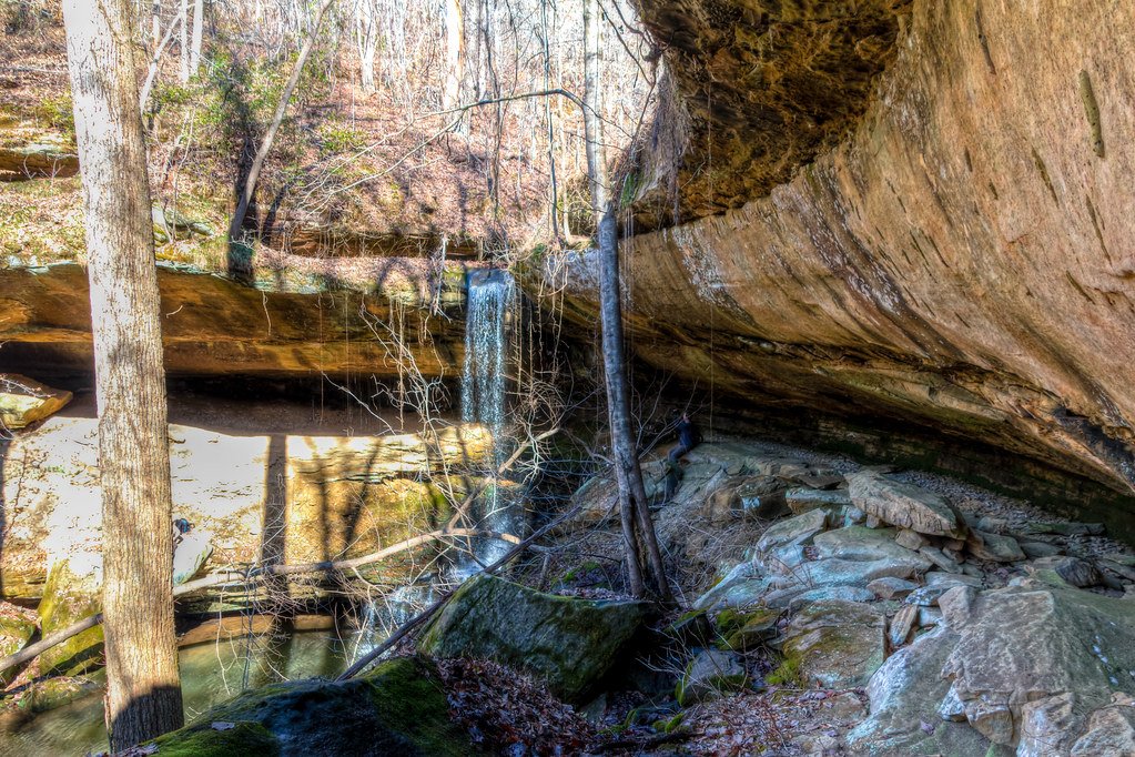
|
Little River Canyon |
|
| Notable Landmarks: | ||
|
 Little River Canyon
Wikimedia – Richard A. Weaver Click on image to enlarge it |
|
|
 Bankhead National Forest
Wikimedia – Fredlyfish4 Click on image to enlarge it |
|
| Ridge and Valley | |||
| Description: | |||
|
 |
||
| Geology: |
|
||
|
|
||
| Habitats: | |||
|
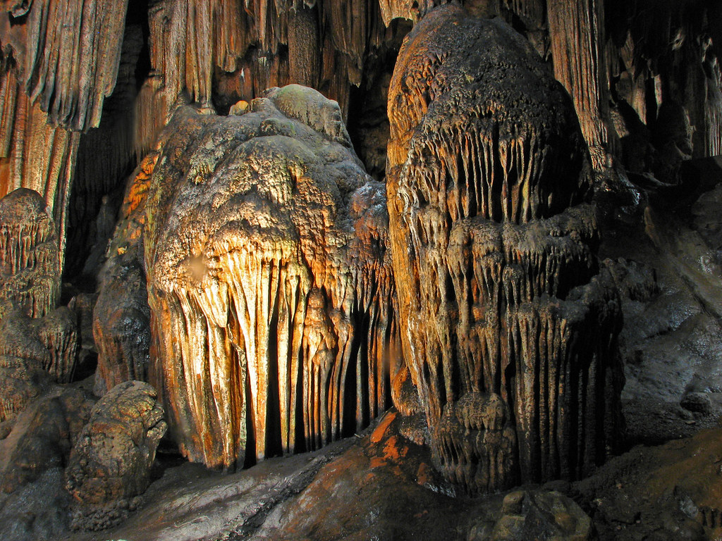 Desoto Caverns
flickr – Roger Smith Click on image to enlarge it |
||
| Notable Landmarks and Species: | |||
|
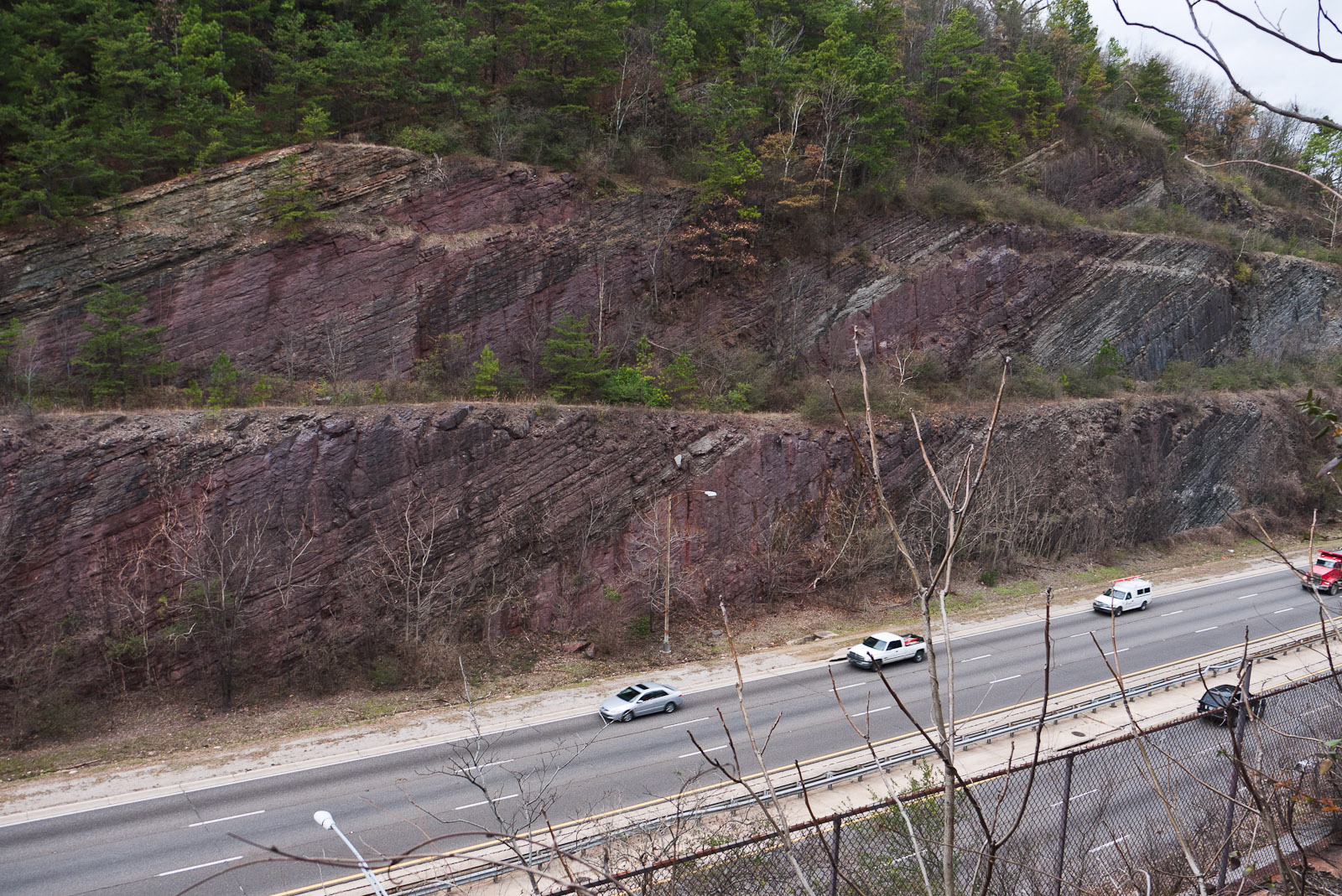 Red Mountain
Wikimedia – Greg Willis Click on image to enlarge it 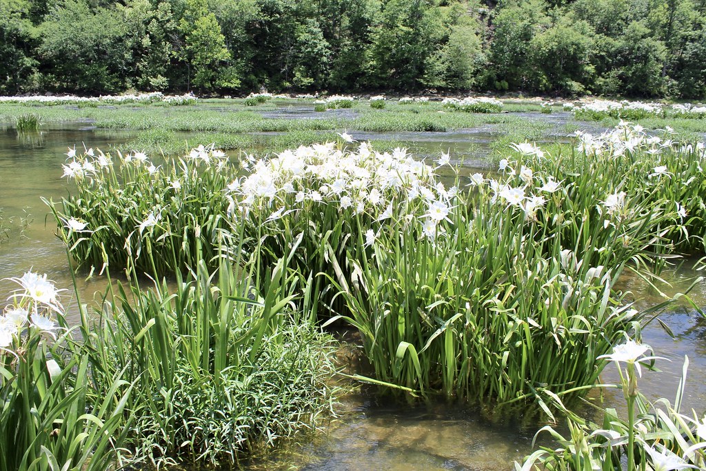
Cahaba Lily |
||
| Piedmont | |||
| Description: | |||
|
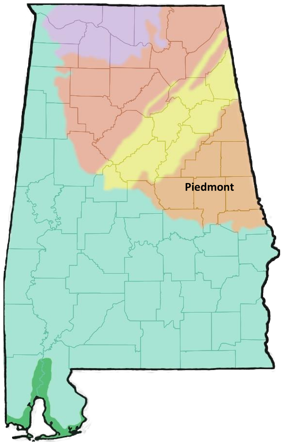
|
||
| Geology: | |||
|
|
||
| Habitats: | |||
|
 Mount Cheaha
Wikimedia – Brian Collins Click on image to enlarge it |
||
| Notable Landmarks and Species: | |||
|
 Chewacla State Park
flickr – Outdoor Alabama Click on image to enlarge it |
||
| Fall Line | ||
|

Fall Line
Image from the online Encyclopedia of Alabama (courtesy of Mike Neilson) Click on image to enlarge it |
|
| Southeastern Plains | ||
| Description: | ||
|
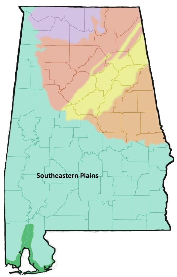 |
|
| Geology: | ||
|
 Conecuh River
Photograph by Alan Cressler Click on image to enlarge it |
|
| Habitats: | ||
|
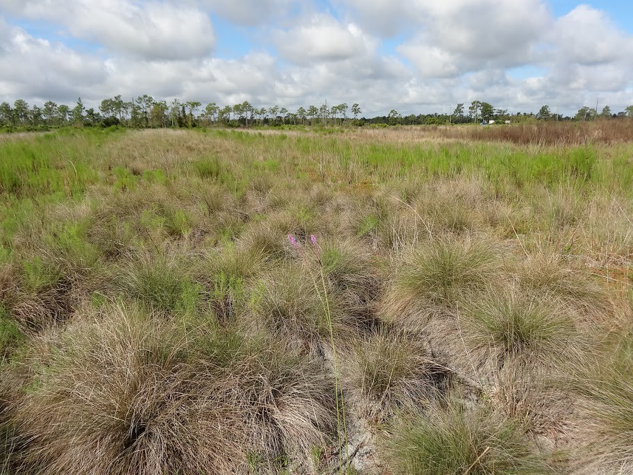 Wiregrass |
|
| Notable Landmarks and Species: | ||
|
 Splinter Hill Bog
photo by Allison Mathis Click on image to enlarge it |
|
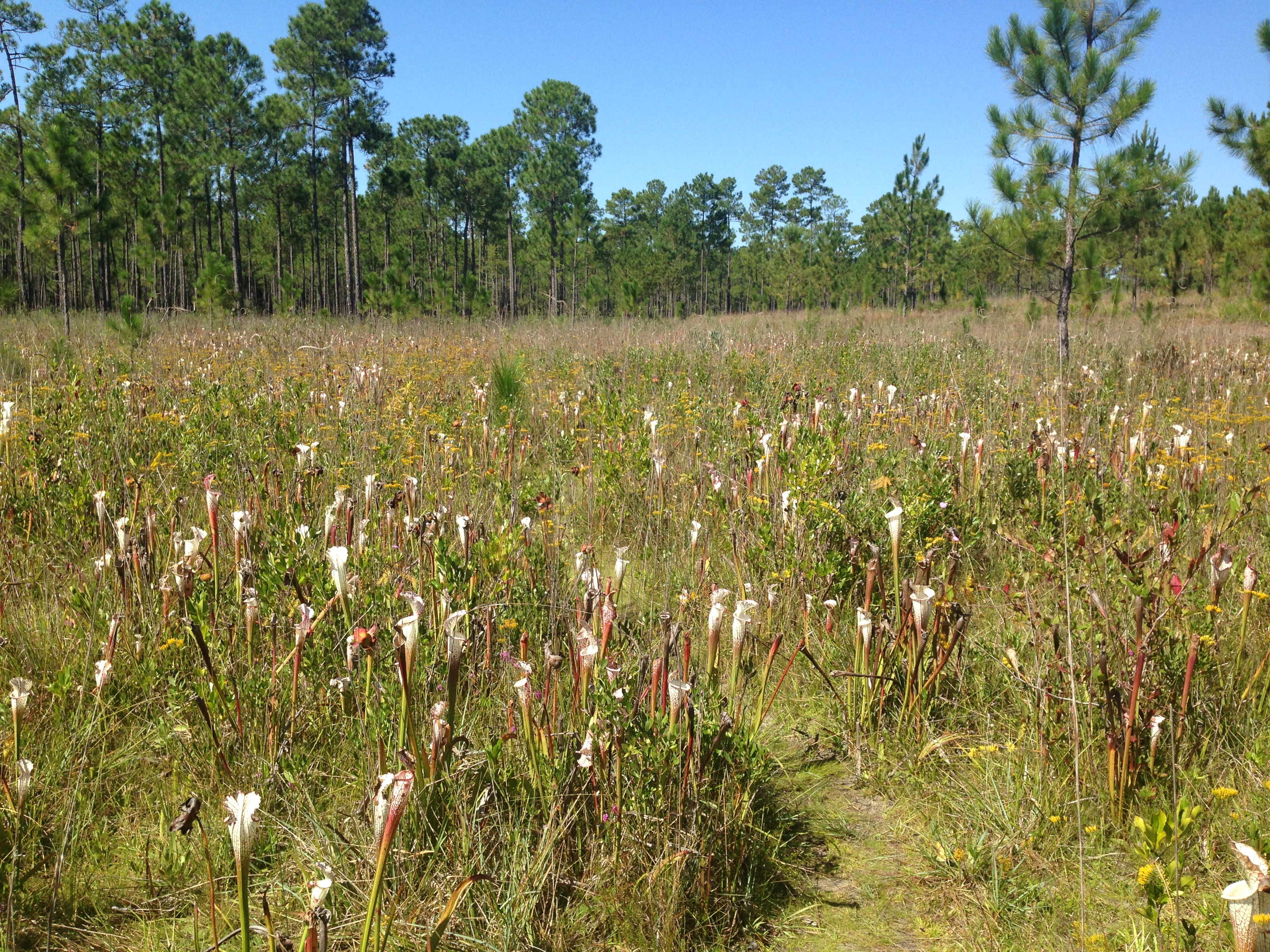 Splinter Hill Bog
photo by Allison Mathis Click on image to enlarge it |
||
| Southern Coastal Plain | |||
| Description: | |||
|
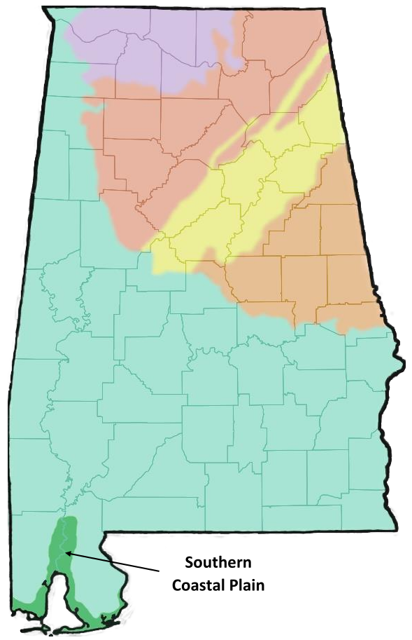 |
||
| Geology: | |||
|
|
||
| Habitats: | |||
|
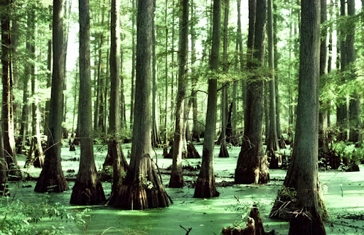 Bald Cypress Swamp
Image from the online Encyclopedia of Alabama (Photograph by Manfred Mielke) Click on image to enlarge it |
||
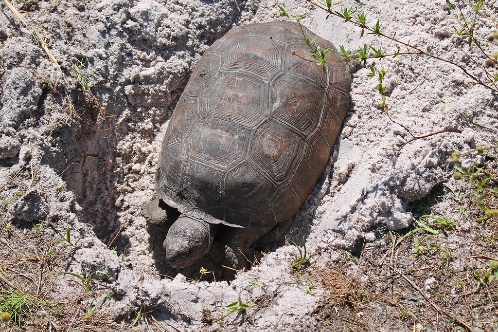
| Notable Landmarks and Species: | |||
|
 Sand Dune at Dauphin Island
flickr – Michael McCarthy Click on image to enlarge it |
||
|
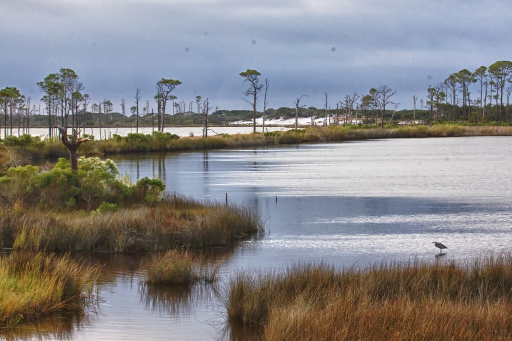 Bon Secour National Wildlife Refuge
flickr – U.S. Fish and Wildlife Service Southeast Region Click on image to enlarge it |
||
SOURCES USED FOR THIS PAGE:
|
|
 |
|
|
|
|
|
|
|
|
|
| Ecoregions of Alabama and Georgia | ||